In short
The Courchevel Altiport sits above Courchevel 1850 at 2,007 m, according to the town hall that runs it. Its runway is 537 m long and 40 m wide, with a slope of up to 18.5%, and it is cleared of snow all winter. Visitors can take scenic flights with Alpine Airlines, walk down to the village, or watch landings from three authorised spotting areas.
What is the Courchevel Altiport?
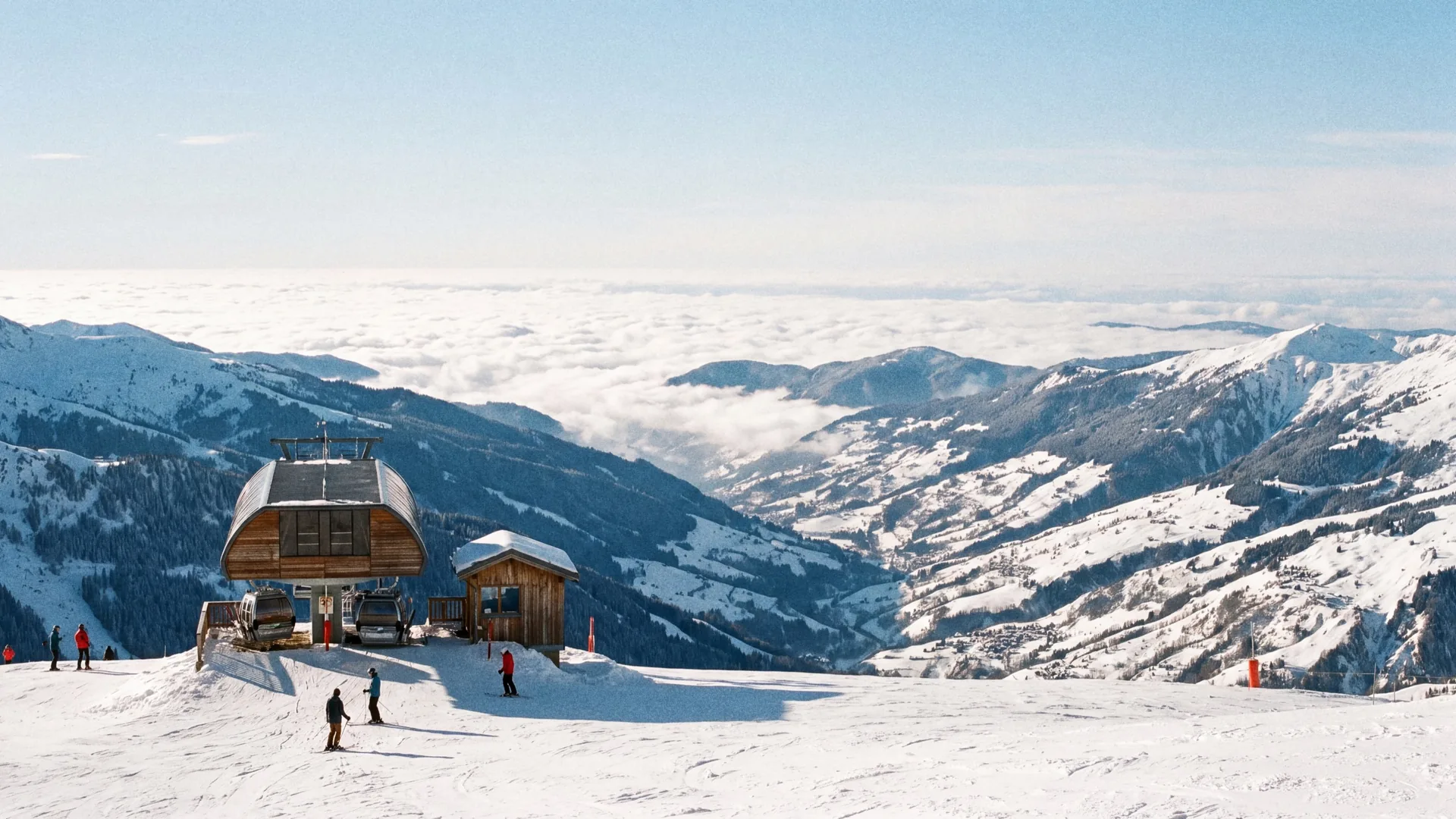
The Courchevel Altiport is a mountain airfield at the top of Courchevel 1850, run by the town hall of Courchevel. Its official website gives these figures:
| Key fact | Courchevel Altiport |
|---|---|
| Altitude | 2,007 m |
| Runway length | 537 m |
| Runway width | 40 m |
| Slope | Up to 18.5% |
| Original runway | 375 m, lengthened and widened for the 1992 Albertville Olympics |
| First landing | 31 January 1962 |
| Winter snow clearing | Permanent, since 1971 |
| Operating hours | 9 am to 7 pm local time, no night flights |
The town hall describes it as the highest runway in Europe and the only altiport in Europe kept clear of snow throughout the winter. The site has a watchtower, two welcome chalets, hangars and a fuel station. Courchevel Tourism, which gives the altitude as 2,006 m, adds that the ski slopes start a few metres from the runway. In November 2022 the altiport obtained level 2 of the Airport Carbon Accreditation programme, according to the town hall.
Why is the Courchevel runway so unusual?
Because it is short and steep. France's air accident investigation bureau, the BEA, describes a 537 m runway with a concave profile, its slope varying from 12.5% to 18.66%, and notes that the altiport is for restricted use, open only to pilots with a mountain rating and site authorisation.
The word itself was coined here. The town hall's history page states that the term "altiport", now in the dictionary, was invented in 1961 for Courchevel. The project was led by the pilot Michel Ziegler and a small team of mountain aviation enthusiasts; the mayor of the time, Emile Ancenay, approved the runway with his council in 1961. Early passengers came to their plane on skis, before the road was built, and in the 1970s Twin Otter aircraft brought visitors daily from Paris and Geneva.
Who flies from the Courchevel Altiport?
Courchevel Tourism states that Alpine Airlines is the only airline allowed by the French Civil Aviation Authority to carry passengers to Courchevel. Its flying school, created in 2014 and approved as a training organisation since June 2014, is based at the altiport all year, according to the town hall.
The altiport's official website also lists the companies that operate there, most of them helicopter operators:
- Alpine Airlines and Aérosavoie
- SAF, Savoie Hélicoptère, Mont Blanc Hélicoptère and Alpes Hélicoptères
- Hélisécurité, Monacair, Heli-Air-Monaco and Azur Hélicoptère
- HBG France, Sky-Cam, Jet Systems Hélicoptères, Blugeon Hélicoptères, Swift Copters and Hélicoptères de France (HDF)
A listing does not mean every company offers public flights every day, so contact the operator directly for transfers or charters. Courchevel Tourism notes that a free shuttle links the altiport with the resort centre, alongside hotel shuttles and taxis.
Can you take a scenic flight from the Courchevel Altiport?
Yes. Courchevel Tourism lists panoramic flights with Alpine Airlines from 15 minutes to 1 hour:
| Flight | Duration |
|---|---|
| Panoramic flight over Les 3 Vallées | 15 minutes |
| Les 3 Vallées and Val d'Isère | 30 minutes |
| Mont Blanc panoramic flight | 60 minutes |
Alpine Airlines says its sightseeing flights run all year, always subject to good weather, with commentary from the pilot, and that it sells gift vouchers. It can be reached on +33 (0)4 79 08 31 23. Courchevel Tourism also lists introductory flying lessons with certified instructors.
For a slower view, the tourist office lists Skivol, which flies one hot-air balloon for up to five passengers, with morning flights from the Courchevel Altiport at sunrise.
Can you walk to the Courchevel Altiport in winter?
Yes, and the easiest way is to walk down from it. Courchevel Tourism publishes a marked winter itinerary, "The heights of Courchevel 1850", that starts at the top of the altiport and ends in the heart of the resort.
- Distance: 3 km
- Time: about 1 hour 15 minutes
- Height: top point 2,100 m, 40 m of ascent and 260 m of descent
- Level: green, easy, and free
- Season: 1 December to 30 April, depending on snow and weather
The route follows the road, passes the Pralong farm, then runs alongside the Zen slope and the Bellecôte piste down to the village, with panoramic views and chalets along the way. Take the free shuttle up and walk back down. Our Courchevel 1850 guide explains the rest of the village.
Is there cross-country skiing near the altiport?
Courchevel's Nordic area offers more than 50 km of free, marked and groomed trails, according to Courchevel Tourism. In Courchevel 1850, the access points are the rue de Plantret and the top of the Chenus gondola.
One route is easy to confuse with the airfield: the red Nordic itinerary "Courchevel 1850, Méribel Altiport, Courchevel" leaves from the bottom of the rue de Plantret and goes to the Méribel Altiport and back. It is a free 15 km round trip with 450 m of ascent, graded hard, open from 6 December to 19 April subject to snow. Les 3 Vallées counts two altiports in its ski area, so check which one a route or booking refers to.
Where can you photograph planes at the Courchevel Altiport?
The town hall authorises aviation photographers, or spotters, in three areas during the winter season, from 1 December to 30 April:
- Below the Altipôle, along the bin store, going down the road from the altiport on the right after SAF.
- At the bend leading to the restaurant Le Cap Horn.
- On the Praméruel ski slope, behind the restaurant Le Pilatus.
A map of the zones is published on the altiport website, and the site is under video surveillance at all times, so stay within these areas. Flights only operate between 9 am and 7 pm, so the late afternoon is the last window for landings.
What time is sunset at the altiport for photos?
Golden light at the top of the resort comes early in winter. These are the sunset times for Courchevel published by Sunrise-sunset.org; the surrounding peaks can hide the sun before the official time.
| Date | Sunset |
|---|---|
| 1 December 2026 | 4.52 pm |
| 21 December 2026 | 4.53 pm |
| 15 January 2027 | 5.16 pm |
| 15 February 2027 | 6.00 pm |
| 15 March 2027 | 6.39 pm |
For a session in this part of the resort, Riva Photography Courchevel connects you with a private photographer who skis, so portraits by the runway can continue on the slopes nearby. Our best photo spots in Courchevel lists other settings, and our proposal guide covers planning a surprise. Prices start at 590 € for 1 hour and 30 photos, all taxes included. To check availability, write to us on WhatsApp via the contact page.
Frequently asked questions
How long is the Courchevel Altiport runway?
The runway is 537 m long and 40 m wide, according to the town hall of Courchevel, which runs the altiport. Its slope reaches up to 18.5%.
How high is the Courchevel Altiport?
The town hall gives an altitude of 2,007 m and calls it the highest runway in Europe. Courchevel Tourism gives 2,006 m.
Can tourists fly from the Courchevel Altiport?
Yes. Courchevel Tourism lists Alpine Airlines panoramic flights of 15, 30 and 60 minutes, including a Mont Blanc flight, subject to weather. Introductory flying lessons are also offered.
Is the Courchevel Altiport open in winter?
Yes. The runway has been cleared of snow permanently since 1971, and the town hall describes it as the only altiport in Europe accessible throughout the winter. It operates from 9 am to 7 pm, with no night flights.
Where can I watch planes land at Courchevel?
From 1 December to 30 April, the town hall authorises spotters in three areas: below the Altipôle on the road down after SAF, at the bend to Le Cap Horn, and on the Praméruel slope behind Le Pilatus.
Planning a session in Courchevel?
Send us your dates and where you are staying. We reply on WhatsApp within the hour with an available photographer and a quote.
Message us on WhatsAppBook a photographer in Courchevel
Sources
Facts, times and rules in this guide come from these sources, checked in October 2026.
- Mairie de Courchevel, Altiport today, checked October 2026.
- Mairie de Courchevel, history of the Altiport, checked October 2026.
- Mairie de Courchevel, Altiport regulations and spotting zones, checked October 2026.
- Mairie de Courchevel, Altiport operators, checked October 2026.
- Mairie de Courchevel, Altiport flying school, checked October 2026.
- BEA, investigation report BEA2016-0200, Courchevel Altiport (PDF), checked October 2026.
- Courchevel Tourism, Courchevel Altiport, checked October 2026.
- Courchevel Tourism, plane flights from the altiport, checked October 2026.
- Courchevel Tourism, air activities (Skivol balloon), checked October 2026.
- Alpine Airlines, overflight of Mont Blanc and the Alps, checked October 2026.
- Courchevel Tourism, The heights of Courchevel 1850 (winter walk), checked October 2026.
- Courchevel Tourism, Nordic ski area, checked October 2026.
- Courchevel Tourism, Nordic route Courchevel 1850, Méribel Altiport, checked October 2026.
- Les 3 Vallées press guide, key figures (two altiports), checked October 2026.
- Sunrise-sunset.org, Courchevel December 2026, checked October 2026.
- Sunrise-sunset.org, Courchevel January 2027, checked October 2026.
- Sunrise-sunset.org, Courchevel February 2027, checked October 2026.
- Sunrise-sunset.org, Courchevel March 2027, checked October 2026.